


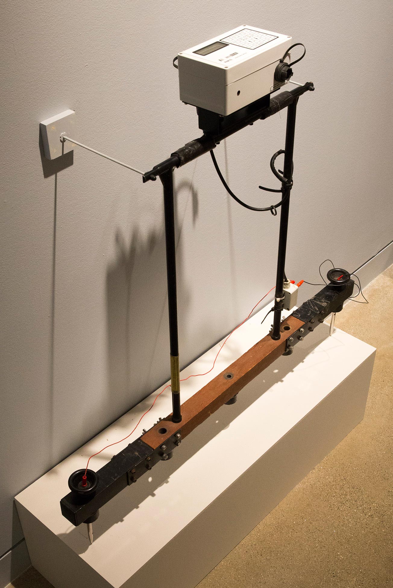
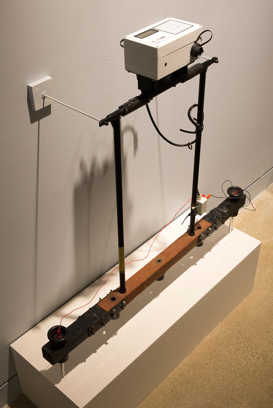
Earth Resistance Meter
This instrument is a Geoscan Research RM15 earth resistance meter loaned by Archaeo-Physics, LLC (data logger) and Ohio Valley Archaeology, Inc. (frame). It consists of two probes connected by a crossbar. Current is injected into the ground from one probe and measured in the other. (Another set of remote probes connected by cables complete the electrical circuit.) The measurements are recorded on a data logger mounted on the crossbar.
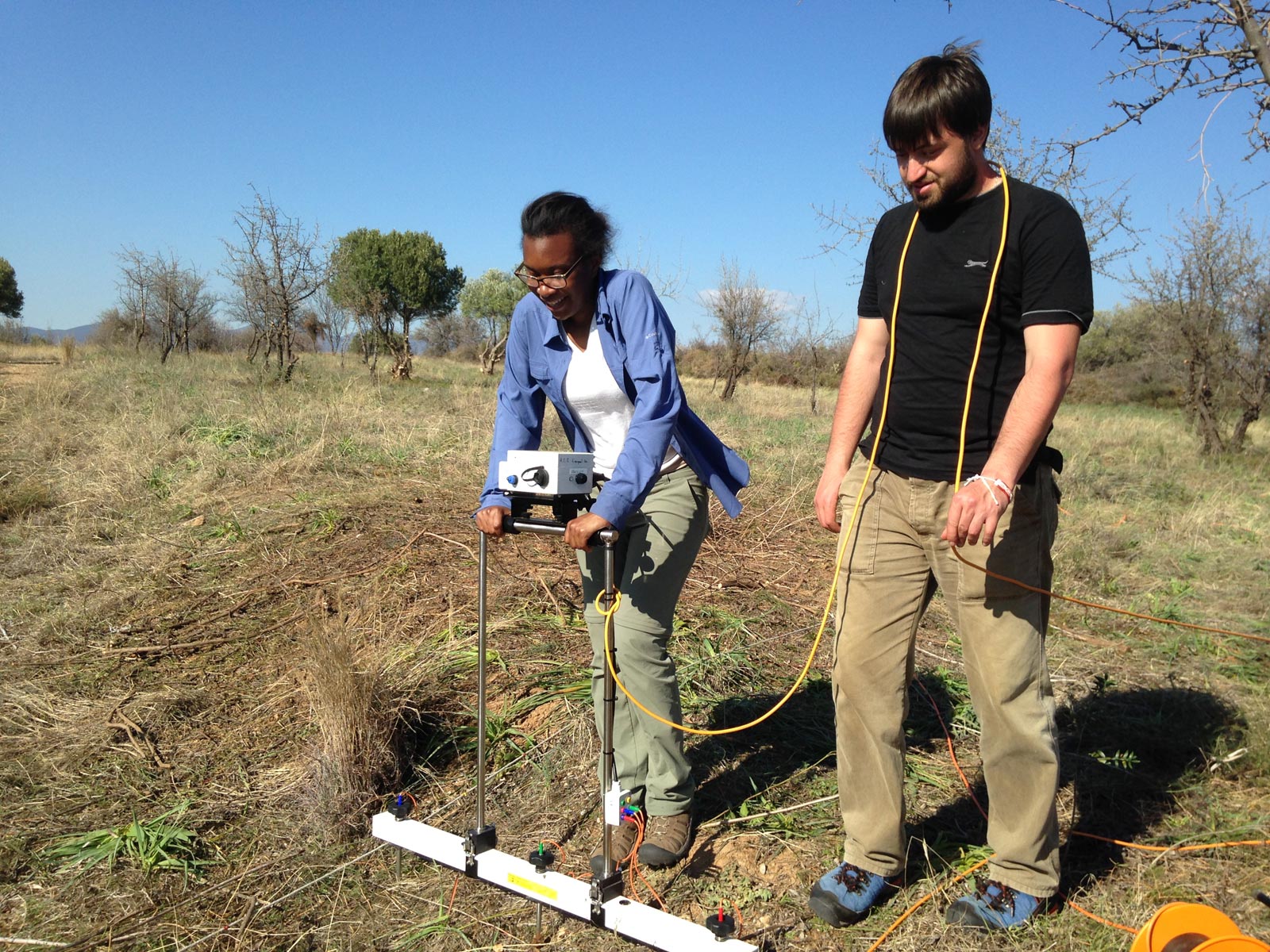
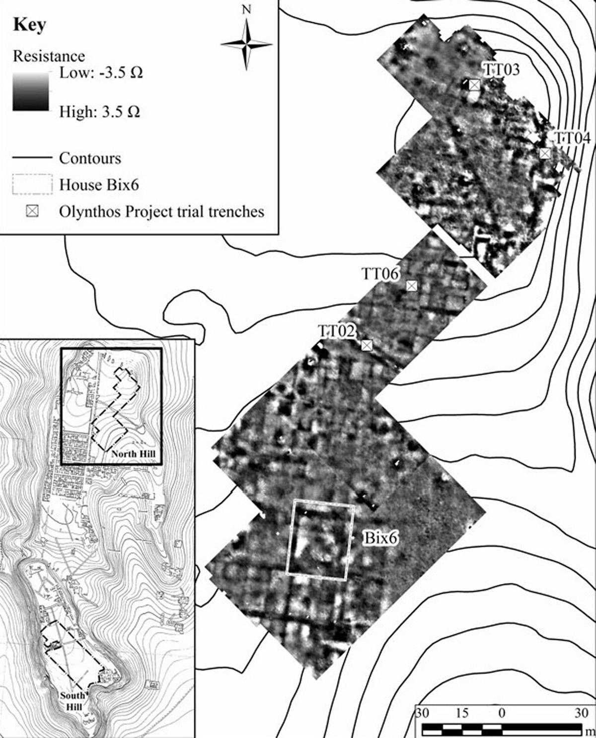
A resistance meter is an instrument used to measure how well soil conducts electrical current. Because stones are generally less conductive than soil, measurements taken in the area of buried stone walls will be noticeably different from measurements taken elsewhere. By gridding out an area and taking hundreds of measurements at regular intervals, it is possible to map buried buildings and indeed whole neighborhoods such as the South Hill at Olynthos without digging. This is one of several techniques of geophysical prospection that have revolutionized archaeology.
