


Introduction

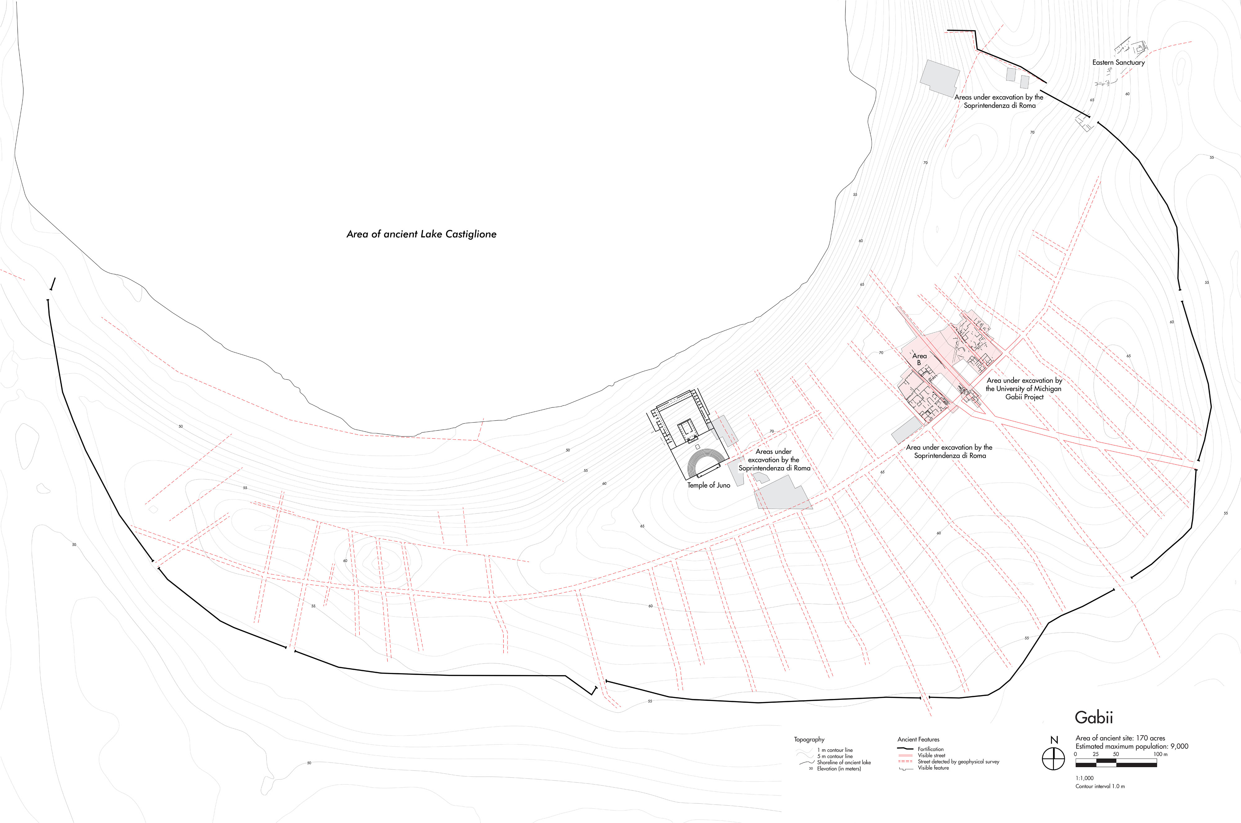
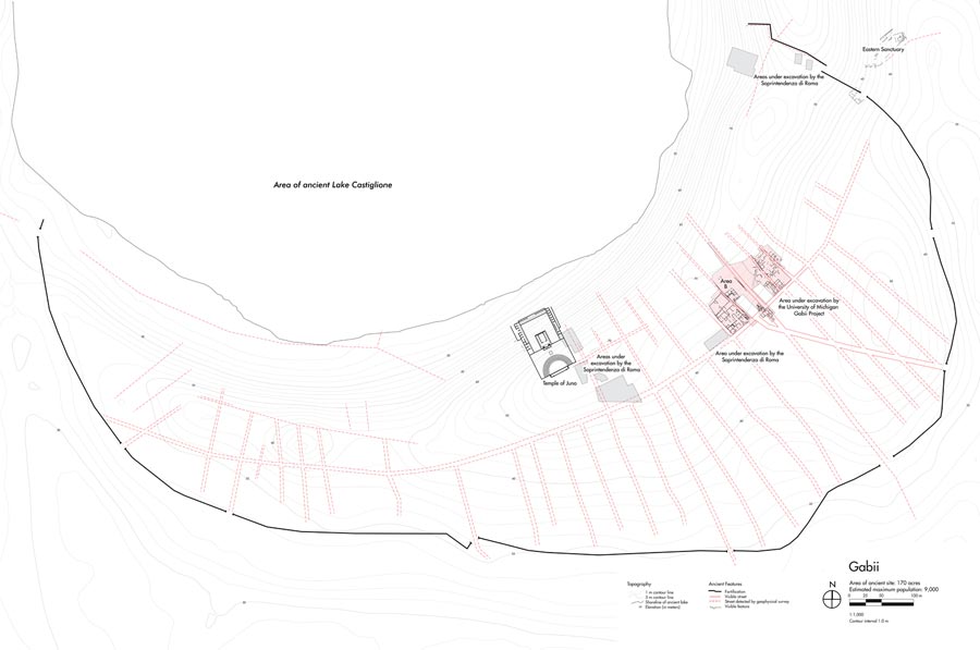
Gabii (GAB-ee-ee) is the oldest of the cities explored in this exhibition. It emerged in the early 1st millennium BC at the same time as Rome, only 11 miles to the west. For centuries, Gabii, Rome, and other central Italian towns competed with each other for prestige and visibility. Eventually, as Rome established itself as the region’s dominant force, it began to absorb the populations and resources of its neighbors. By 100 BC, Gabii had been reduced to a fifth of its maximum size.
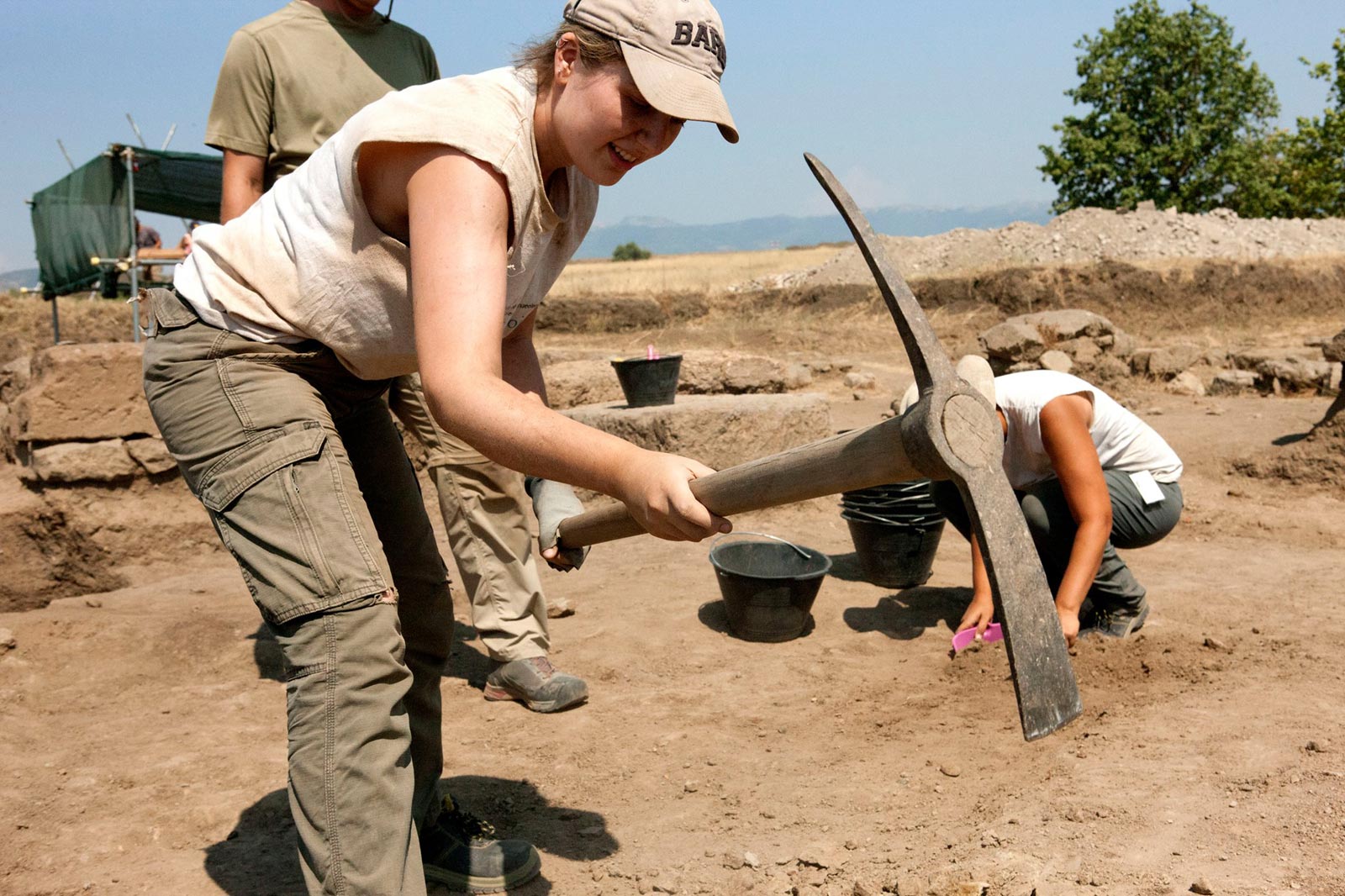
In 2006, the Kelsey Museum launched a program of archaeological research at Gabii to answer the following questions: Why did Rome instead of Gabii become the regional metropolis? How did communities such as Gabii adapt to Roman supremacy? The new light shed by large-scale excavations on urbanism at Gabii also helps us understand the early development of Rome, where early habitation levels are much less accessible. In addition, the Gabii project has established itself as a pioneer in digital recording and publication methods.
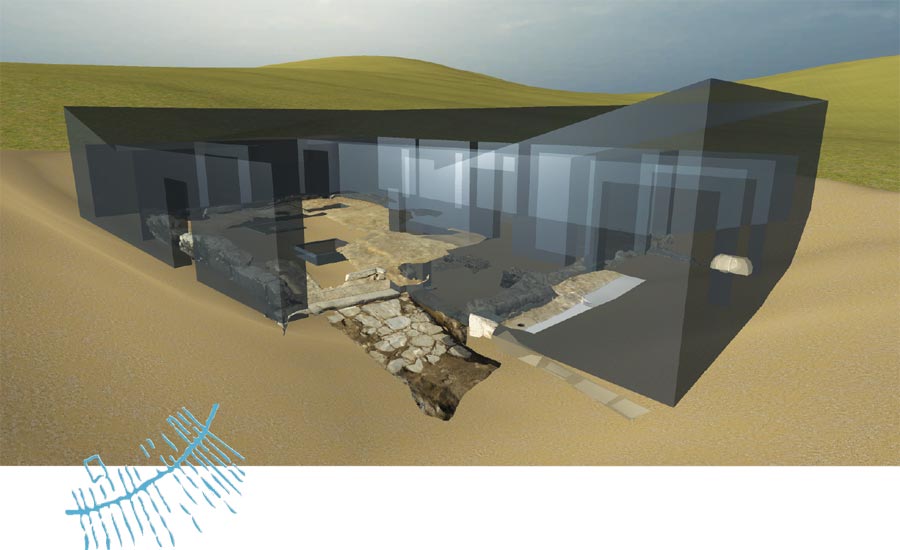
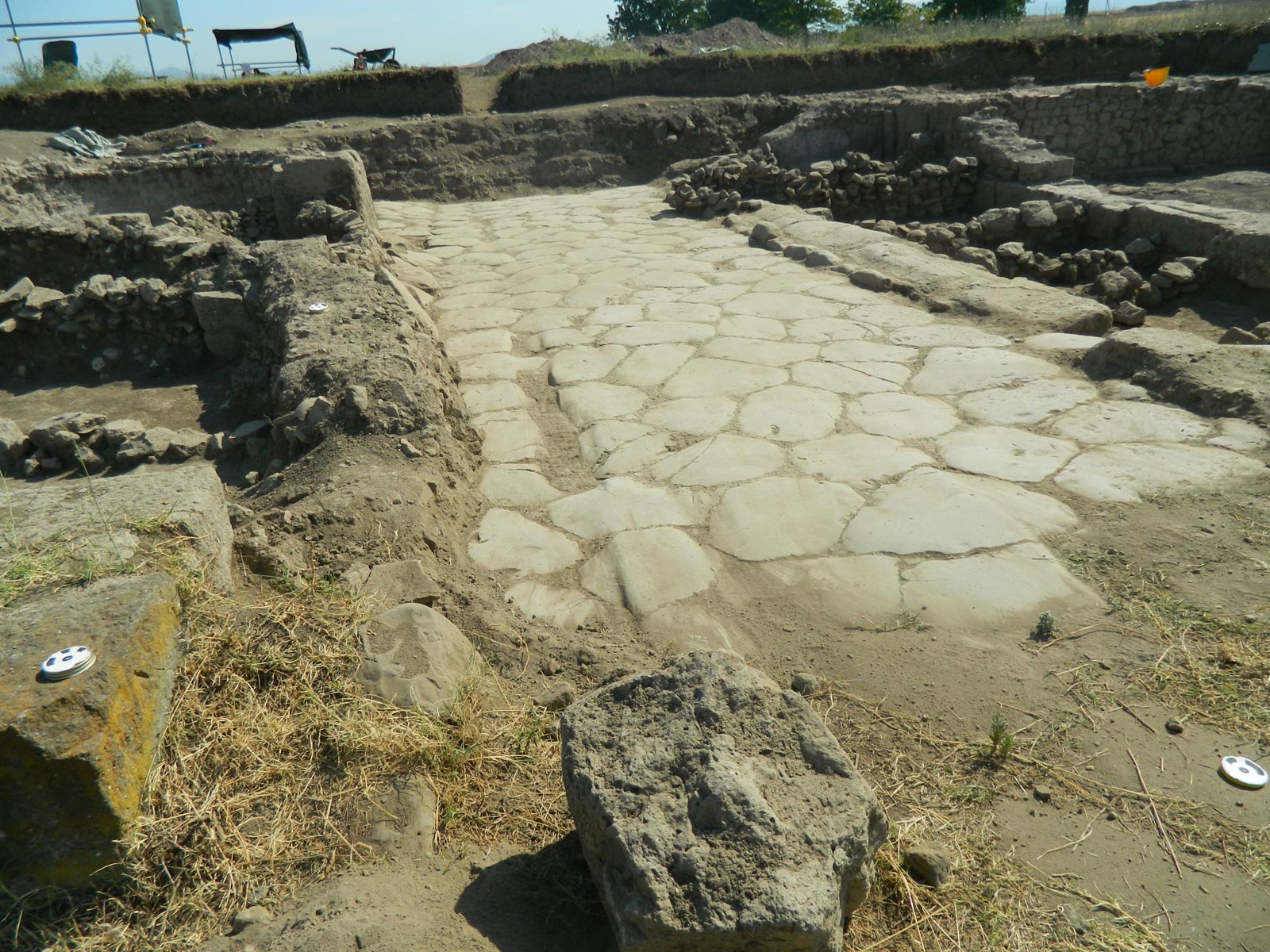
A major focus of excavations at Gabii has been a part of the site known as Area B. A large townhouse was built in Area B in the late 3rd century BC and occupied for 200 years. In the late Roman period (3rd–4th centuries AD), the area was reused as a cemetery, where the sarcophagus displayed in replica form in this exhibition was found. An online publication of the excavations at Area B was issued in 2017 by the University of Michigan Press.