


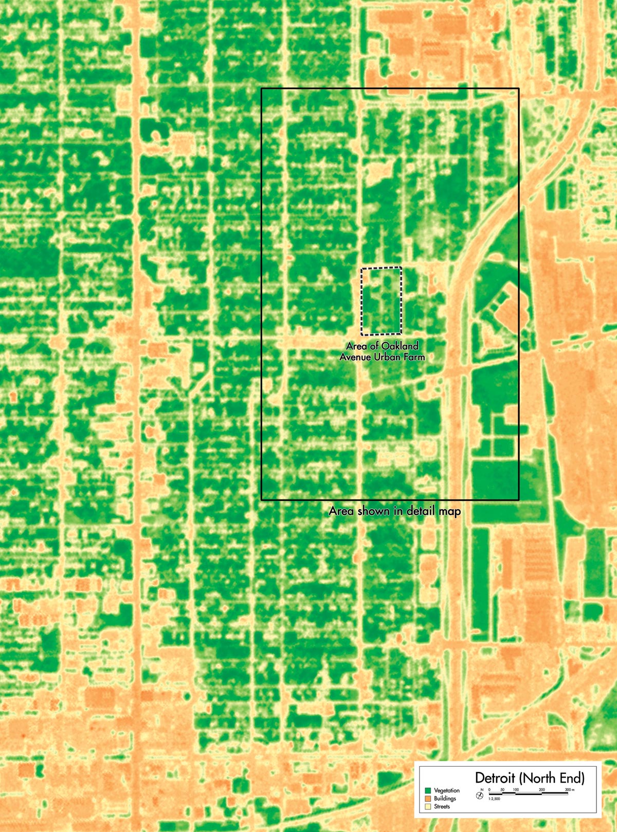
Satellite Images
Different kinds of vegetation reflect light differently. These variations can be recorded in multispectral satellite images, which isolate and capture different wavelengths across the electromagnetic spectrum. Analysis of multispectral images can help distinguish between “natural” vegetation, such as grass and forest, and cultivated crops. Archaeologists use multispectral images to identify farmland, which is more suitable for archaeological survey than forest or open pasture. Multispectral imagery can also be useful in measuring the impact of urban farming and the transformation of residential neighborhoods in Detroit, and in planning for the future.

This image of the area around Detroit’s North End and the Oakland Avenue Urban Farm uses data from near-infrared wavelengths to measure the density of vegetation, shown here in green. As technology advances and the resolution of multispectral imagery becomes more refined, it will eventually be possible to discern and measure even small-scale land uses such as urban agriculture.
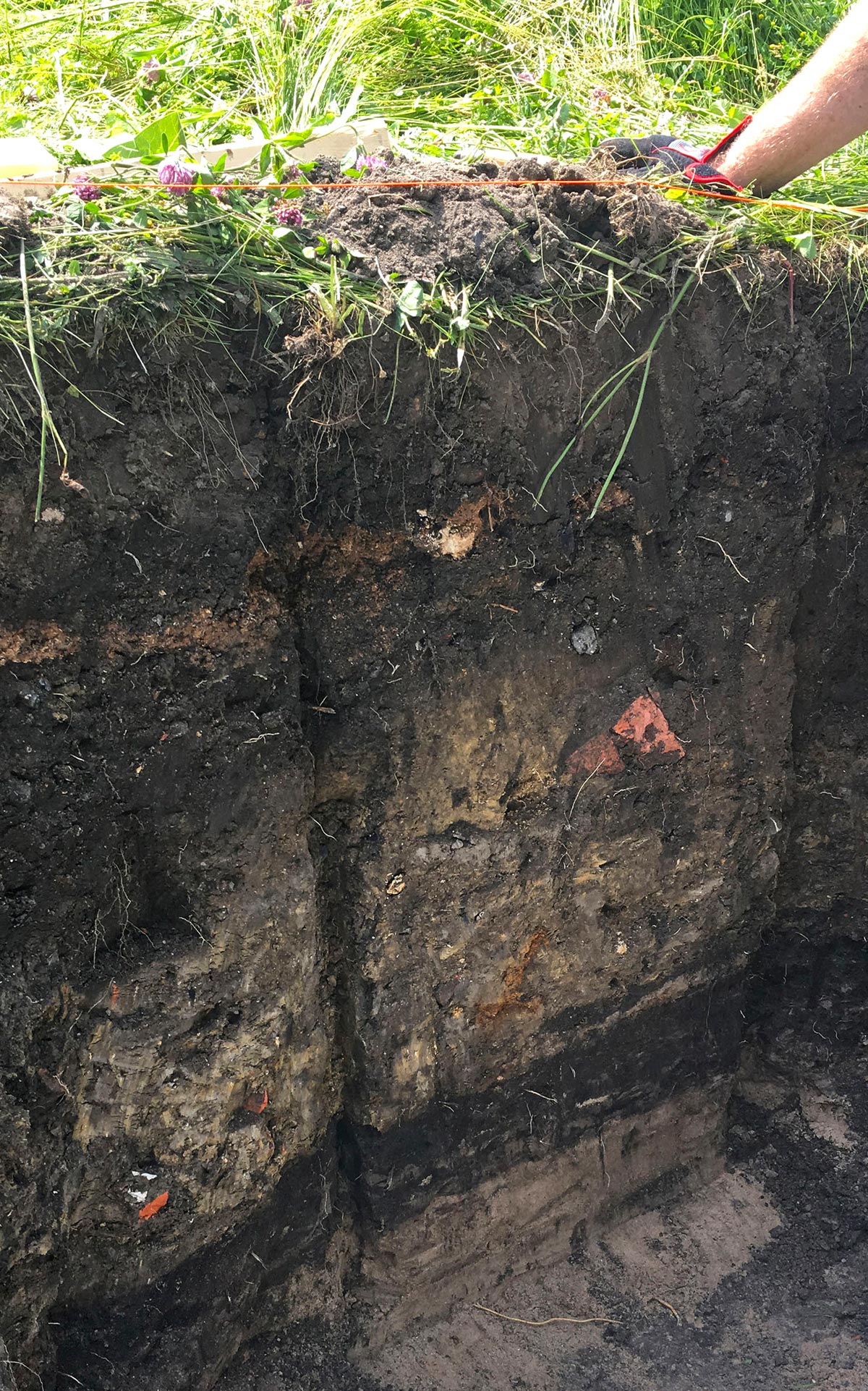
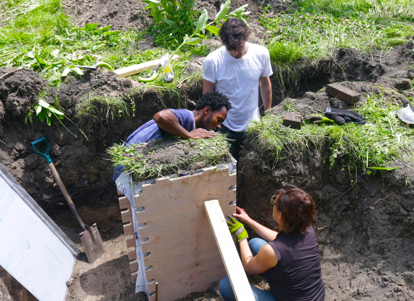
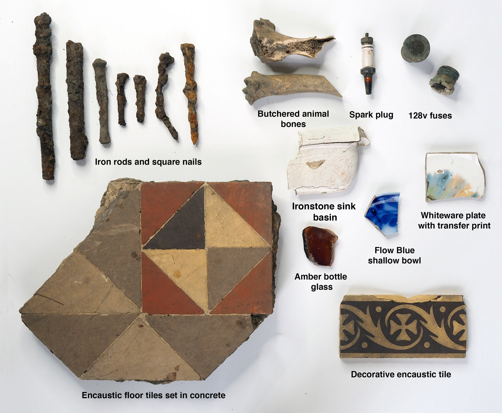
Soil Sample
Farmers routinely sample the fertility of their soil. Archaeologists use soil cores (vertical soil profiles) to preview excavation areas, for example, to determine how deep ancient remains are buried. Soil samples in Detroit are being used for both purposes: to test the soil for nutrients or possible contaminants, and to capture a glimpse of the history of a small part of the city.
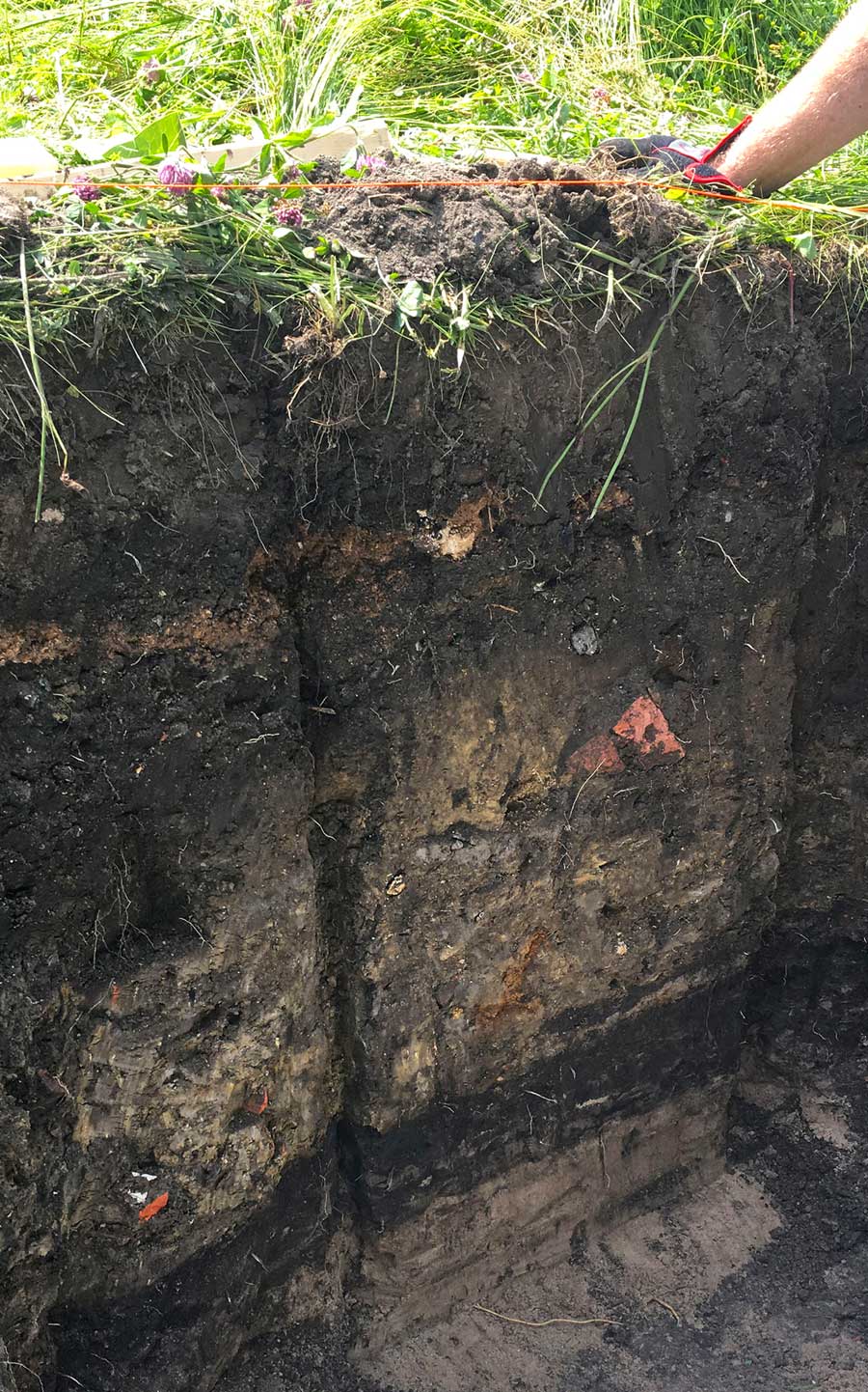
This soil sample is a vertical block of earth excavated from a former residential property at 9174 Goodwin Street, now part of the Oakland Avenue Urban Farm in Detroit’s North End. Extracted near a back alley where a garage once stood, it shows buried building materials and trash mixed deep into the fine sediments below the topsoil. Near the bottom of the block is a layer of dark organic soil, and below that can be seen the upper part of the sand layer deposited by the ancient lakebed.