
 |
 |
 |
 |
 |
 |
 |
 |
Maps
Location
Karanis (present-day Kom Aushim) is in the fertile region of the Fayum, near Lake Moeris, which is fed by a branch of the Nile. The first settlements in the area were in prehistoric times, and farming was introduced early in the Pharaonic period, during the Old Kingdom. More intensive exploitation of the area for its agricultural potential began in the Middle Kingdom, when the water level of the lake was lowered for a project that reclaimed and irrigated a vast area of fertile land.
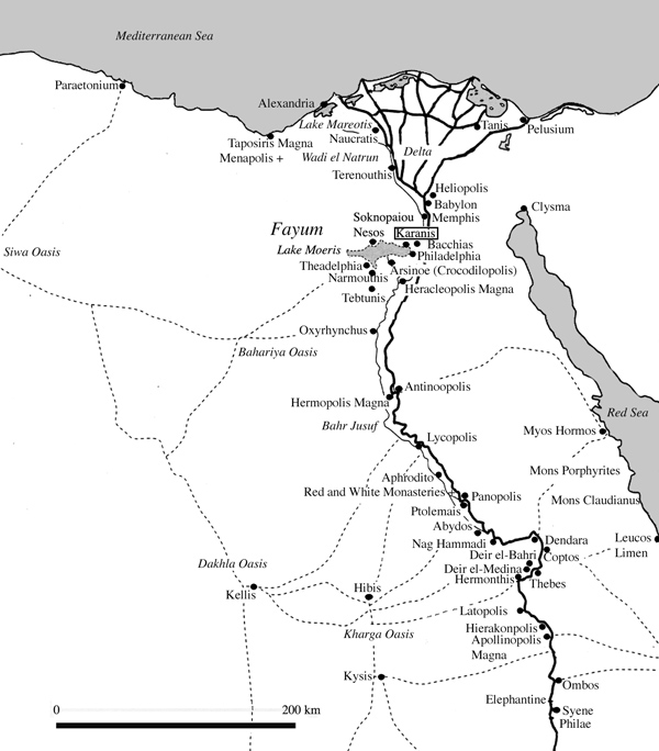
1.
Map of Egypt
Cities and settlements during the Ptolemaic, Roman, and Byzantine periods
2.
Map of the Fayum region of Egypt
Landscape and towns during the Ptolemaic, Roman, and Byzantine periods
1.
Map of Egypt
Cities and settlements during the Ptolemaic, Roman, and Byzantine periods
2.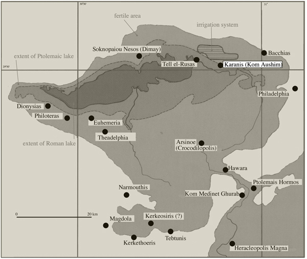
Map of the
Fayum region of Egypt
Landscape and towns during the Ptolemaic, Roman, and Byzantine periods