
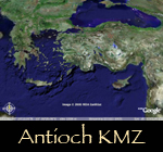
Google Earth® Flydown to Antioch
An overhead view of the 3D restoration of Antioch has been mapped over the location of the city on the globe.
In order to use this feature, you must have the free Google Earth ®
browser installed on your computer.
This program and support information are available at: http://earth.google.com/
When you are ready, just click on the image below to download the file (860Kb) to your computer, unzip it if necessary (Stuffit Expander® etc. ), then open it with Google Earth®. [Macintoch: you may need to control-click the image and select the "save to desktop" option. (You should have Antioch.kmz.) Windows: you may be prompted to unzip the .kmz file, if so you can open the included .kml file with Google Earth®.]
NOTES:
The first-known and best-preserved of Antioch's aqueducts can be seen running NE from the city as a thin black line.
The city immediatly to the west of Antioch is modern Yalvac, Turkey.
This feature can be use over dial-up, but will take at least 5-15 minutes to load the textures and terrain.