The Building of the First Aswan Dam and the Inundation of Lower Nubia:
Images from the Collections of the Kelsey Museum
The Nile River is the main artery for Egypt and Nubia: the present course
of the river, traceable to at least 25,000 years ago, is a determining factor
of the topography of the region. In a relatively rainless region, it is only
because of the river's annual flood that these areas became habitable and
airable.
The yearly flood of the Nile is caused by late summer rains in the plateau
region of Ethiopia, which in turn swell the tributaries of the Nile. At the
peak of the flood, the volume of the river's flow increases by as much as
sixteenfold. Variable amounts of rainfall to Ethiopia cause stunning
differences in the amount of flooding seen farther down the course of the Nile.
In a "lean year," such as 1913-1914, 12 billion cubic meters of flood water
swelled the river. A "fat year," such as 1878-79, saw the level of the river
increase by 155 billion cubic meters of water.
At the turn of the century, agricultural production was being outstripped
by the growth of the population in Egypt and the Sudan: the Nile had to be
controlled if there was to be agricultural stability along its banks.
Harnessing the power of the Nile would also yield the hydroelectric power
necessary for industry. To the increasingly industrial societies of the
region, the choice was clear. In 1899, construction of the first Aswan Dam
was begun. Completed in 1902, its height was raised in subsequent building
campaigns of 1907-12 and 1929-34. Even with these renovations, the first, or
"Low," dam proved to have an inadaquate reservior area. In the event of
extreme flooding, it would be necessary to open the sluices of the dam to
relieve the water pressure against it, flooding the areas thought to be
protected. A second dam was necessary at Aswan, and in the early 1950s, designs
began to be drawn for what was to become the High Dam as Aswan. With the
signing of the Nile Water Agreement by Egypt and the Sudan in November of 1959,
work began on the second Aswan dam.
The bulding of the High Dam at Aswan would have grave implications. Much of
Lower Nubia would be submerged under the reservior created by the dam,
destroying momuments and archaeological sites from the First to the Third
Cataracts of the Nile River. Ambitious rescue operations were begun in 1960,
after an appeal was issued by Vittorino Veronese, the then Director-General
of UNESCO.(United Nations Educational, Scientific, and Cultural Organization)
Three stages of operations were necessary: survey of the area,
excavation of archaeological sites, and the final movement of as many
endangered monuments as was possible.
Twenty monuments from the Egyptian part of Nubia and four monuments from
the Sudan were dismantled, relocated and re-erected. Many others were
identified during the survey, and were documented before their subsequent
inundation. Special permits were issued by the Egyptian and Sudanese
governments for archaeological excavations conducted by multinational teams
of researchers, including those from the University of Pennsylvania. In the
end, however, time ran out. It became clear that it would not be possible to
document many of the sites of Lower Nubia completely, and that much of the
information which careful archaeological excavation can yield would be lost
forever.
The Photographs:
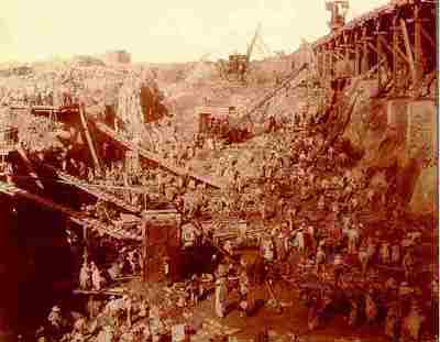
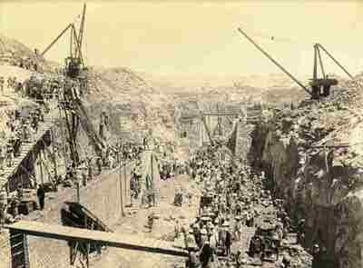
Many of these photographs depict the building of the first Aswan Dam at the
turn of the century. Others depict the canals and sluices of the dam shortly
after construction. In several cases, the photographs were acquired from the
Publication Department of the United States Department of Agriculture, while
the source of the remaining photographs is unknown.
West Channel Masonry Looking East (from westernmost area of the dam)
April 30, 1901
D.S. George, photographer
KM 61.7.679b
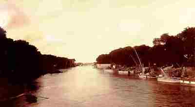
Navigation Channel
July 10, 1901
D.S. George, photographer
KM 61.7.675
From the West Bank Looking East
October 1, 1901
D.S. George, photographer
KM 61.7.678
Cast Iron Lining for Sluices Being Put in Place
Undated
D.S. George, photographer
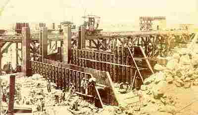
KM 61.7.679a
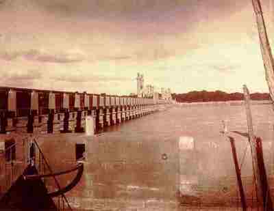
Western End of the Aswan Dam from Downstream
January 7, 1902
Photographer unknown

KM 61.7.677
High Level Sluice, South Side of Dam
March 12, 1900
D.S. George, photographer
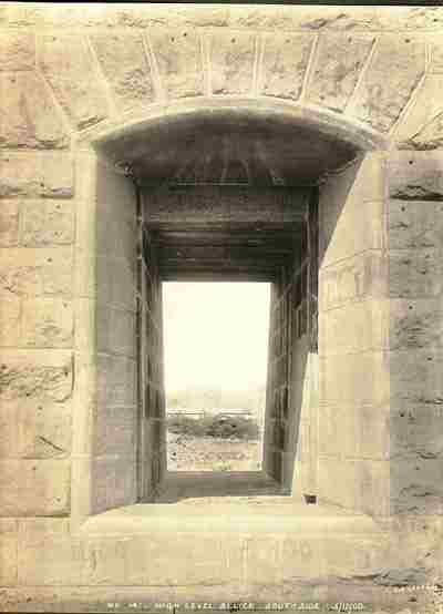
KM 61.7.680
View from the Headgate of the Menifia Canal Looking North
Undated
Photographer unknown
KM 61.7.682
Lateral Headgate of the Menufia Canal
Undated
Photographer unknown
KM 61.7.681a
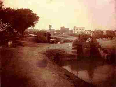
Headgate and Lock of the Menufia Canal
Undated
Photographer unknown

KM 61.7.681b
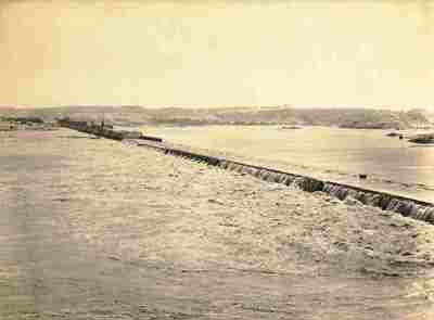
Damietta Barrage from the Eastern Bank of the Nile
Undated
Bonfils, photographer
KM 61.7.674a
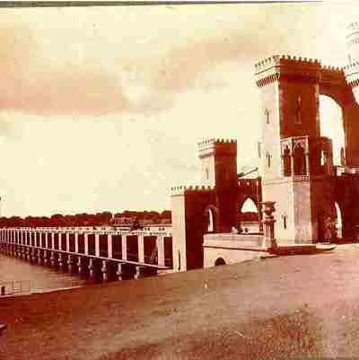
The Rosetta Barrage from the West Bank of the Nile
Undated
Photographer unknown
KM 61.7.674b
View of Philae Island and Temples from the South
Before 1899
Photographer unknown
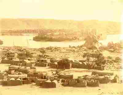
KM 61.7.616
This view shows Philae before the completion of the first Aswan Dam.
The Partially Inundated Temples of the Philae
After 1902
Photographer unknown

KM 61.7.1225
The Kiosk of Trajan is in the foreground, while the Temple of Isis is at the
right rear. The reservior of the first Aswan Dam flooded the complex for much
of each year.
The Great Temple of Ramses II at Abu Simbel
Undated
Photographer unknown
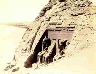
KM 61.7.619
The Nile can be seen in the background of this photograph. After the building
of the first Aswan Dam, the reservoir waters could at times reach the feet
of the seated figures.